


Monroe County--Bloomington City PUMA, Indiana
About
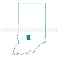
Outline

Summary
| Unique Area Identifier | 192874 |
| Name | Monroe County--Bloomington City PUMA |
| State | Indiana |
| Area (square miles) | 411.32 |
| Land Area (square miles) | 394.51 |
| Water Area (square miles) | 16.81 |
| % of Land Area | 95.91 |
| % of Water Area | 4.09 |
| Latitude of the Internal Point | 39.16075090 |
| Longtitude of the Internal Point | -86.52332530 |
Maps

Graphs
Select a template below for downloading or customizing gragh for Monroe County--Bloomington City PUMA, Indiana


Neighbors
Neighoring Public Use Microdata Area (by Name) Neighboring Public Use Microdata Area on the Map
- Bartholomew & Jackson Counties--Columbus City PUMA, IN
- Greene, Daviess, Owen, Orange & Martin Counties PUMA, IN
- Morgan, Putnam & Brown Counties PUMA, IN
Top 10 Neighboring County (by Population) Neighboring County on the Map
- Monroe County, IN (137,974)
- Morgan County, IN (68,894)
- Lawrence County, IN (46,134)
- Jackson County, IN (42,376)
- Greene County, IN (33,165)
- Owen County, IN (21,575)
- Brown County, IN (15,242)
Top 10 Neighboring County Subdivision (by Population) Neighboring County Subdivision on the Map
- Perry township, Monroe County, IN (50,673)
- Bloomington township, Monroe County, IN (44,167)
- Washington township, Morgan County, IN (17,073)
- Richland township, Monroe County, IN (14,343)
- Van Buren township, Monroe County, IN (11,981)
- Washington township, Owen County, IN (6,164)
- Clear Creek township, Monroe County, IN (5,000)
- Washington township, Brown County, IN (4,896)
- Marshall township, Lawrence County, IN (4,660)
- Jackson township, Brown County, IN (4,002)
Top 10 Neighboring Place (by Population) Neighboring Place on the Map
- Bloomington city, IN (80,405)
- Ellettsville town, IN (6,378)
- Smithville-Sanders CDP, IN (3,184)
- Harrodsburg CDP, IN (691)
- Stinesville town, IN (198)
Top 10 Neighboring Unified School District (by Population) Neighboring Unified School District on the Map
- Monroe County Community School Corporation, IN (120,715)
- North Lawrence Community Schools, IN (34,125)
- Martinsville Schools Metropolitan School District, IN (30,507)
- Spencer-Owen Community Schools, IN (17,974)
- Richland-Bean Blossom Community School Corporation, IN (17,259)
- Brown County County School Corporation, IN (15,242)
- Brownstown Central Community School Corporation, IN (10,375)
- Eastern Greene County School District, IN (8,077)
Top 10 Neighboring State Legislative District Lower Chamber (by Population) Neighboring State Legislative District Lower Chamber on the Map
- State House District 60, IN (70,940)
- State House District 61, IN (67,665)
- State House District 65, IN (64,454)
- State House District 46, IN (63,864)
- State House District 47, IN (62,157)
- State House District 62, IN (60,681)
Top 10 Neighboring State Legislative District Upper Chamber (by Population) Neighboring State Legislative District Upper Chamber on the Map
- State Senate District 40, IN (139,764)
- State Senate District 39, IN (126,383)
- State Senate District 37, IN (125,824)
- State Senate District 44, IN (123,667)
Top 10 Neighboring 111th Congressional District (by Population) Neighboring 111th Congressional District on the Map
- Congressional District 4, IN (789,835)
- Congressional District 9, IN (729,076)
- Congressional District 8, IN (694,398)
Top 10 Neighboring Census Tract (by Population) Neighboring Census Tract on the Map
- Census Tract 5110, Morgan County, IN (7,342)
- Census Tract 9506, Lawrence County, IN (7,284)
- Census Tract 2.01, Monroe County, IN (6,924)
- Census Tract 2.02, Monroe County, IN (6,421)
- Census Tract 12, Monroe County, IN (5,898)
- Census Tract 10.02, Monroe County, IN (5,879)
- Census Tract 16, Monroe County, IN (5,759)
- Census Tract 13.01, Monroe County, IN (5,648)
- Census Tract 8, Monroe County, IN (5,600)
- Census Tract 15.01, Monroe County, IN (5,523)
Top 10 Neighboring 5-Digit ZIP Code Tabulation Area (by Population) Neighboring 5-Digit ZIP Code Tabulation Area on the Map
- 47401, IN (41,011)
- 47403, IN (30,955)
- 46151, IN (30,921)
- 47421, IN (27,831)
- 47408, IN (24,776)
- 47404, IN (21,026)
- 47460, IN (11,471)
- 47424, IN (9,525)
- 47429, IN (7,986)
- 47448, IN (7,505)